![[German Museum Bonn]](../bilder/dm-bonn-small.gif)
![[University of Bonn]](../bilder/fr_wilh_trans.gif)
![[Carnegie Mellon University]](../bilder/scsbannertrans.gif)
|
|
|

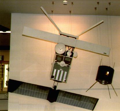
ERS-1 is the first European remote sensing satellite, and is nearly 12 m in height. Its four instruments gather climatic and environmental data from the surface of the earth. ERS-1 has been in polar orbit since 1991; it has since been joined by the second European satellite, ERS-2.
The most important instrument on board the satellite is a synthetic-aperture radar (SAR). This provides sharp pictures even in the dark or through cloud cover. SAR transmits radar pulses to earth and records the echo received; ground stations can then calculate meaningful and detailed images of the surface.
The ERS-satellites provide, for example, information on the propagation speed of ocean waves, the structure of the arctic ice, or wind speed and direction.