ConTouring
Context aware bicylce touring
ConTouring
Navigational Software today allows a single user to follow a planned route and
forces him to stay on this route. Anything except following the route is
impeded by the software.
ConTouring tries to overcome these limitations. It provides means to
automatically adapt the route due to the cyclists speed and preferences and
other sensory inputs.
Groups are initally supported by ConTouring, so it is possible to
collaboratively plan a route and the adaptions include every members needs.
ConTouring is made up of different components to aid the users to plan and perform a bicylce tour.
RoutePlanner
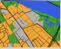
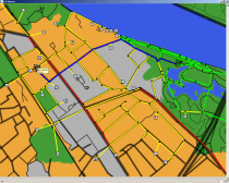
The RoutePlanner is the main component for planning a tour. It shows a street
map and different points of interest like museums, restaurants, hotels etc.
For planning a route the user selects a starting point, a starting time,
several waypoints and an endpoint. The best route and estimated arrival time
will then be – according to the user profile – automatically
calculated.
The user profile contains information about the users preferences e.g the
average speed the user travels at and what type of streets the user likes to
ride on. See User Profiles for details. These
preplanned routes can be saved and later be loaded into the navigator to
follow this planned route.
These user preferences are used to color the streets so the user can
select the best route.
Navigator
The Navigator component is responsible for tracking the progress of the cycling
group. The preplanned routes can be loaded into the navigator and will be shown
in the map. A a connected gps device then reads the users position and displays
it in the street map.
If the cyclists deviate from the planned schedule, either they are ahead or
behind the schedule, the system proposes alternatives to the planned route. If
they are ahead of the schedule different points of interest are shown on the
map so the cyclists can do a replanning and visit a museum or some other sight.
On the other case, the cyclists are behind the schedule and it is becoming late
the system proposes accomodations the user could go to.
User Profiles
All these adaptive changes in the Navigator and the coloring and display of the
streets in the RoutePlanner are based on the user profile. The users can
specify what types of streets they like (e.g. beautiful, fast or special bike
roads), what speed and duration they normally travel, what types of sights they
like, what needs they have on accomodations and after which time of deviation
from the schedule they want get a new proposal.
All these information is used to calculate the best route during the planning
and show preferred alternative goals during the actual cycling.
Group support
Normally a cycling tour is undertaken not by an individual but by a group. When
people meet to plan a tour the devices on which ConTouring runs can build a
group via bluetooth.
The different members of the group may have different preferences stated in
their user profile. By forming a group these differences are taken into account
during the planning and during the actual cycling. So it is possible to find
the best compromise in the route that is planned and the proposed adaptions.
Research Context
The ConTouring was developed as a part of the Context Sensitive Intelligence Project (CSI). It's goal is to investigate different adaption techniques and scenarios.
Further Information
You are welcome to ask for details. Please contact Holger Mügge, Daniel Speicher, Tobias Rho or Pascal Bihler
overview
Content
People
Contact: See top of start page


